June 22, 2009In November 2008, Caroline Moore, a 14-year-old budding astronomer in Warwick, New York, discovered a supernova. And not just any supernova: This exploding star, dubbed SN 2008ha, was surprisingly dim — some 1,000 times dimmer than a typical supernova. The first official reports examining SN 2008ha’s strangeness are now appearing in scientific literature.
Moore, a ninth-grader at Warwick Valley High, has garnered the distinction of being the youngest person ever to discover a supernova. And that honor is helping her to inspire a new generation of kids into the hobby of astronomy. “This year is the International Year of Astronomy,” Moore says. “We’re really trying to push kids’ involvement.”
Family business
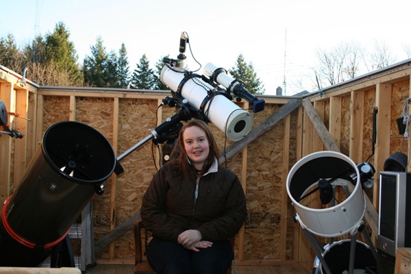
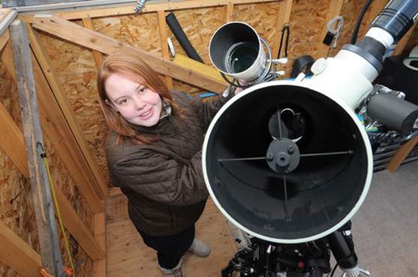
Robert Moore, Caroline’s father, is an avid astroimager and the co-chair of the NorthEast Astro-Imaging Conference. Moore and his daughter enjoy a well-equipped backyard base of operations — Deer Pond Observatory. (Caroline’s telescope is a 10-inch Newtonian reflector.)
The teen’s introduction to serious astronomy was not through an eyepiece, but on a computer screen. In April 2008, she began to participate in an international group called the Puckett Observatory Supernova Search (POSS) team.
POSS uses four robotic telescopes to capture digital images of the sky. The volunteers (eight right now) use special software to comb through the images for novae, or “new stars.” Sometimes the nova is the sudden (and temporary) brightening of a star. But sometimes it is the one-time fireworks of a sun blowing itself to pieces: a supernova.
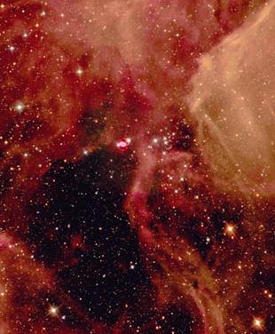
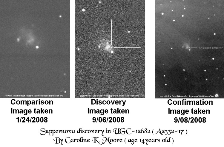
Discovery time!For 7 months, Caroline sifted through POSS images. Then, on November 6, 2008, she found a possible supernova in a galaxy in Pegasus called UGC 12682. It was dim — just 18.8 on the astronomical brightness scale – but it was visible.
Moore’s observation was later confirmed and designated SN 2008ha. Far from Warwick, 60 miles northwest of New York City, scientists quickly turned massive telescopes on SN 2008ha, including the Magellan telescopes in Chile, the MMT telescope in Arizona, the Gemini and Keck telescopes in Hawaii, and NASA’s Swift satellite. Researchers needed the supernova’s spectral fingerprint and other essential data.
A team of scientists led by Ryan Foley at the Harvard-Smithsonian Center for Astrophysics in Cambridge, Massachusetts, determined that SN 2008ha is a peculiar intermediate type of stellar explosion. It may have been a “failed” supernova whose blast was not powerful enough to destroy the entire star.
“Coincidentally, the youngest person to ever discover a supernova found one of the most peculiar and interesting supernovae ever,” says Alex Filippenko, leader of a group of supernova hunters at the University of California at Berkeley. “This shows that no matter what your age, anyone can make a significant contribution to our understanding of the universe.”
Poster kidCaroline continues to work on the supernova search, fitting it in with schoolwork, singing, and participating on the school ski team. How many images has she looked at so far? “Oh, thousands,” she says chuckling, “definitely thousands.” In a typical week, she processes 100 to 200 paired images, looking to notch more supernovae.
Moore is active in the Rockland Astronomy Club, assisting at public star parties and events for other young people. But the hoopla over the supernova discovery has sparked a new “career” for the teen: poster child for attracting a new generation of kids into stargazing.
On February 6, 2009, iOptron Corporation announced Moore as the iOptron Young Astronomer of the Year for the International Year of Astronomy 2009.
In the last week of August, she is going to speak at a public star party on the deck of the USS Intrepid, a World War II aircraft carrier docked on the Hudson River in New York City as part of the Intrepid Sea-Air-Space Museum.
The date has not been set yet, but sometime in the fall Moore will share the stage with astronomer Heidi Hammel at the Andrus Planetarium in Yonkers, New York. Moore says it’s going to be a sort of “before and after” demonstration of where an interest in science can lead. “I’m supposed to be the example of where you start, and Heidi Hammel is supposed to be where you go to,” Moore says. “Those are pretty big shoes to fill!”
But Moore says it’s vital to the future of amateur observing for young people to see kids like her advocating for astronomy. “My discovery has been really helpful to get kids involved with iOptron in the Young Astronomer of the Year,” she says. “We need a future for our hobby.”