Using a NASA radar flying aboard India’s Chandrayaan-1 spacecraft, scientists are getting their first look inside the Moon’s coldest, darkest craters.
The Mini-SAR instrument, a lightweight, synthetic aperture radar, has passed its initial in-flight tests and sent back its first data. The images show the floors of permanently shadowed polar craters on the Moon that aren’t visible from Earth. Scientists are using the instrument to map and search the insides of the craters for water ice.
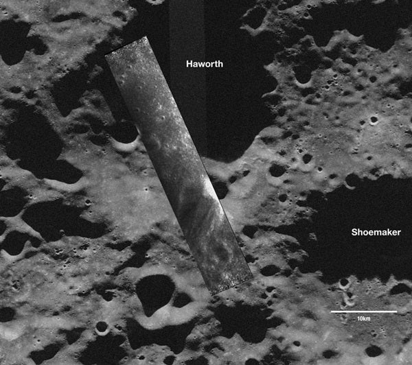
“The only way to explore such areas is to use an orbital imaging radar such as Mini-SAR,” said Benjamin Bussey, deputy principal investigator for Mini-SAR, from the Johns Hopkins University Applied Physics Laboratory in Laurel, Maryland. “This is an exciting first step for the team which has worked diligently for more than three years to get to this point.”
The images, taken November 17, 2008, cover part of the Haworth crater at the Moon’s south pole and the western rim of Seares crater, an impact feature near the north pole. Bright areas in each image represent either surface roughness or slopes pointing toward the spacecraft. Further data collection by Mini-SAR and analysis will help scientists to determine if buried ice deposits exist in the permanently shadowed craters near the Moon’s poles.