Key Takeaways:
- The lunar south pole is emerging as a critical destination for international space exploration, driven by the prospect of discovering water resources and advancing scientific understanding, all coordinated under the nonbinding principles of the Artemis Accords, which promote peaceful and responsible activities in space.
- Decades of observational data from multiple missions, including Clementine, Lunar Prospector, Chandrayaan-1, LRO, and LCROSS, have confirmed the presence of significant water ice deposits within Permanently Shadowed Regions (PSRs) at the Moon's poles, which are vital for future human presence and resource utilization.
- The Artemis Exploration Zone (AEZ) at the lunar south pole, encompassing areas like the South Pole-Aitken Basin and Shackleton Crater, is a high-priority target for geological sample return, expected to yield invaluable data on the Moon's early formation, its impact history, and the origin of lunar volatiles.
- Beyond resource acquisition and geology, the lunar south pole offers unique scientific opportunities, including "Peaks of Eternal Light" for sustainable solar power generation and a radio-quiet environment for advanced radio astronomy, solar wind studies, and potentially the search for extraterrestrial intelligence.
In 1848, James Marshall was building a lumber mill in northern California for his employer, John Sutter. One January morning, Marshall spotted sparkling pebbles within the mill’s outflow; Sutter and Marshall soon realized they had found gold in “them thar hills.” The chance discovery sparked the California Gold Rush, with treasure-seeking scouts streaming to the area from as far away as Hawaii, South America, and even Europe.
The Gold Rush epitomized abundance of a valued resource in a confined area. In this sense, a new gold rush is now in the making at the south pole of the Moon. The spacefaring nations of the world plan to congregate there, digging for not gold but for water and even answers about our satellite’s history. Entrepreneurs may still come to make a quick buck, but many will come hand in hand, with discovery and exploration as their goals.
The Artemis Accords
The Artemis Accords are a series of nonbinding international agreements intended to coordinate exploration of the Moon and beyond, fostering peaceful uses of the solar system’s resources. NASA’s Artemis Accords website (www.nasa.gov/artemis-accords) introduces the concept in its preamble: “With many countries and private companies conducting missions and operations around the Moon, the Artemis Accords provide a common set of principles to enhance the governance of the civil exploration and use of outer space.”
The framework of the Accords hearkens back to the United Nations’ Outer Space Treaty of 1967 and other such international space law treaties. Its guidelines seek to avoid potential conflict or misunderstanding in upcoming industrial space activities like mining, manufacturing, energy generation, and scientific exploration.
The Artemis Accords highlight the commitment by the U.S. and the other signatory nations (currently 55, including the U.S.) for “best practices and norms of responsible behavior.” This includes coordinated rescue efforts in times of crisis, as well as rules of engagement for spacecraft landings and launches from lunar outposts and settlements. The Accords seek to create technological systems that are standardized and compatible, aiding in international cooperation and coordination of activities. The Accords also encourage the public release of scientific data and the preservation of historic locations like the landing sites of Luna 9 and Apollo 11, recognizing them as areas of cultural significance requiring conservation.
Water on the Moon
In a place where the landscape is crushed rock and there’s nothing to drink or breathe, water is an attractive commodity. Water can be used for hydration, or it can be split into oxygen for breathing and hydrogen for fuel.
On the Moon, there is no air pressure to hold liquid water together and it explosively vaporizes. There are only two forms in which water can last under the harsh lunar vacuum: either locked in minerals or as rock-hard ice. In the brutal heat of a lunar day, ice doesn’t stand much of a chance. But at the poles, it’s a different story.
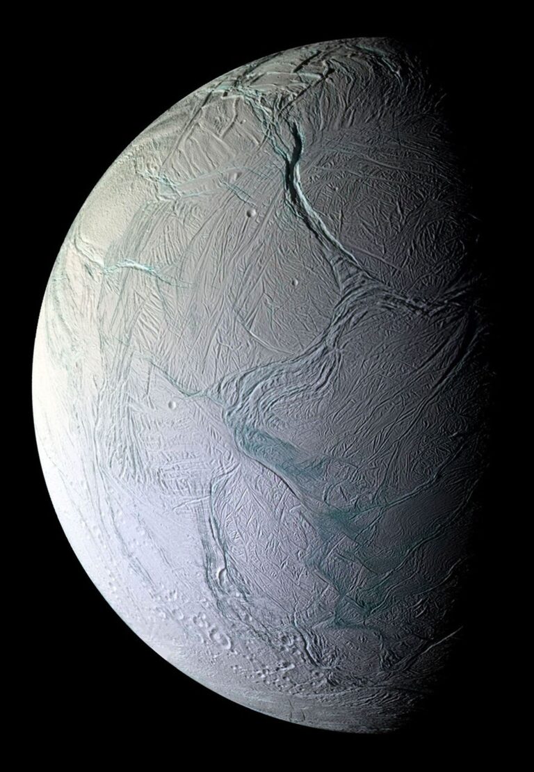
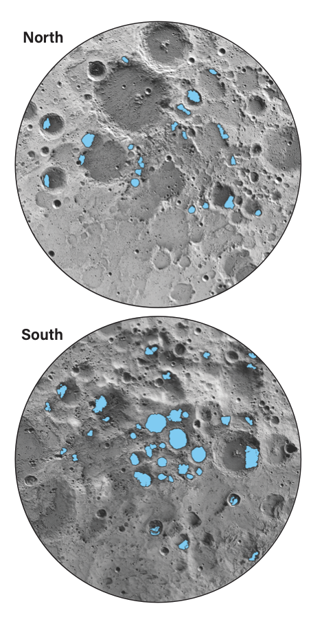
As early as 1961, researchers speculated that the permanently shadowed floors of craters at the lunar poles could form cold traps where water ice might be preserved. Although Earth’s spin axis tilts by some 23.5°, the Moon’s axis is nearly vertical (1.5°), which means at the lunar poles, the Sun remains near the horizon. This keeps the deepest crater floors and valleys in permanent shadow, at temperatures of –285 degrees Fahrenheit (–175 degrees Celsius). Water from comet and asteroid impacts might remain in these so-called permanently shadowed regions, or PSRs.
The first direct measurements of water ice on an airless world came in 1991. A team used the 70-meter antenna at Goldstone, California, to beam radar toward Mercury. The signal that bounced back was highly reflective — a property of very low-temperature water ice, previously seen when imaging the ice caps on Mars — and indicated ice at the mercurian poles.
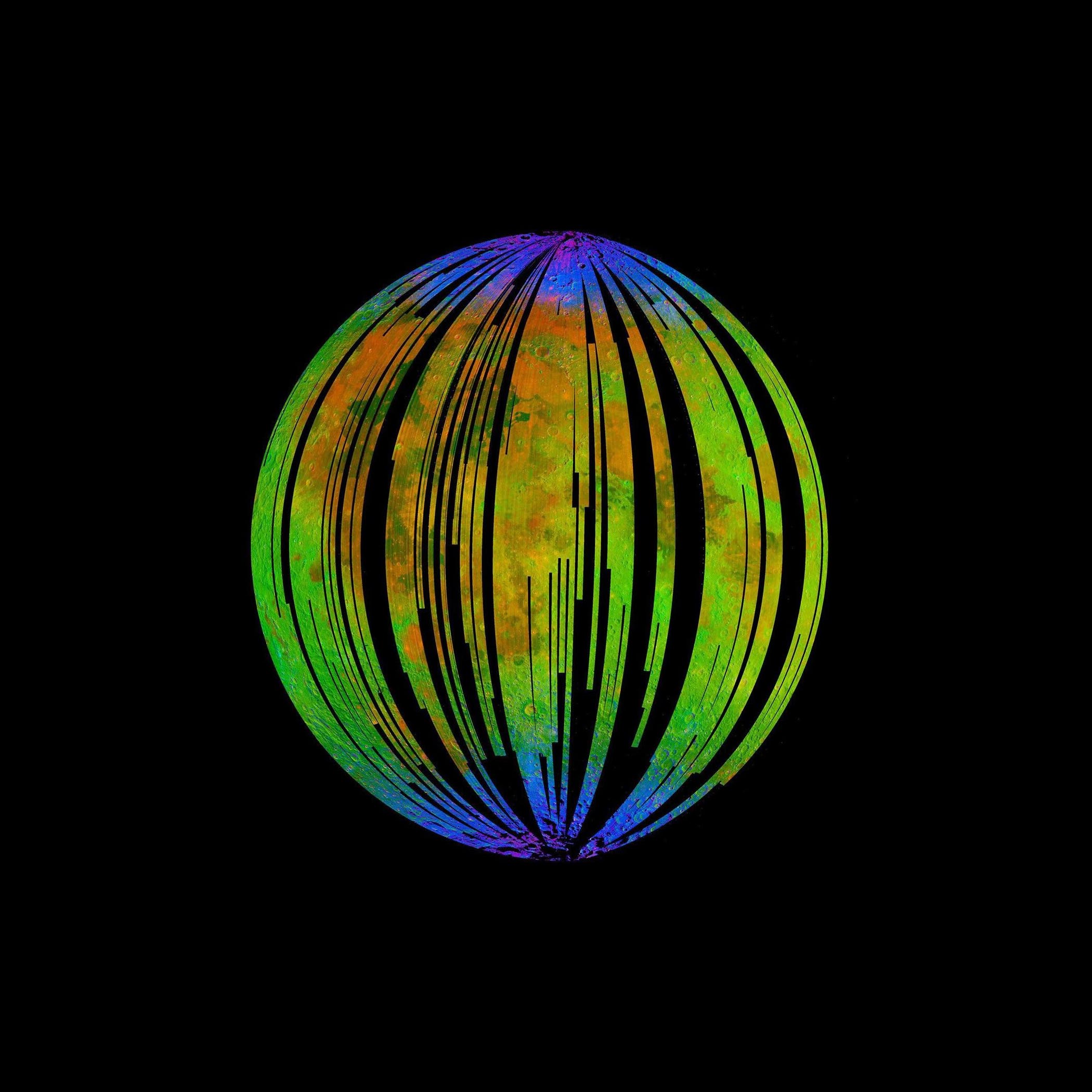
The first hints of water on the Moon came a few years later. In 1994, the NASA/U.S. Defense Department spacecraft Clementine made several polar passes of the Moon. It, too, used radar, and again the characteristics of the signals it received back suggested ice within the surface regolith of some crater floors. Four years later, NASA’s Lunar Prospector spotted significant amounts of hydrogen at both poles — a strong sign they may contain water.
A 2008 analysis of samples returned by Apollo astronauts found hydrogen — a marker for water — inside microscopic fragments of the volcanic glass they contained. The water had likely issued from the Moon’s early volcanoes.
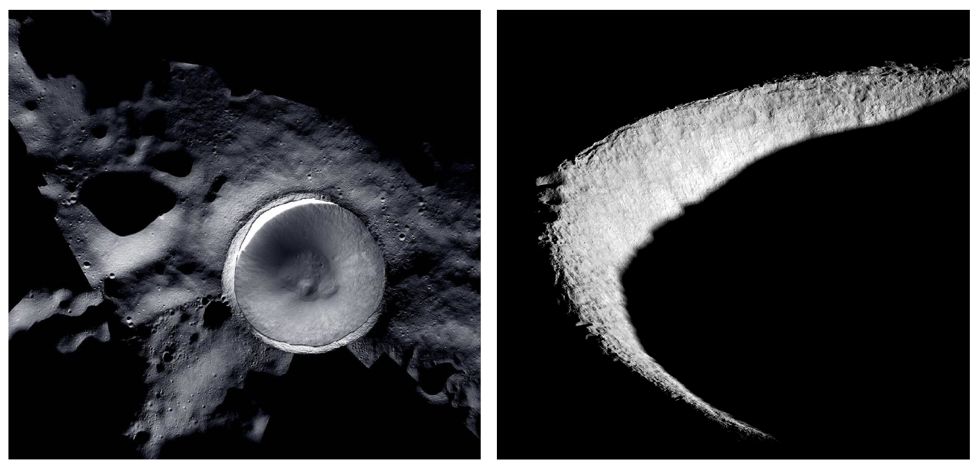
The same year, India’s Chandrayaan-1 Moon orbiter dropped its Moon Impact Probe into Shackleton Crater at the lunar south pole on Nov. 14. Its billowing ejecta showed traces of hydrogen that may have been associated with water, although the data were inconclusive. A year later, results published using data from the orbiter showed absorption associated with water-bearing molecules at the Moon’s poles.
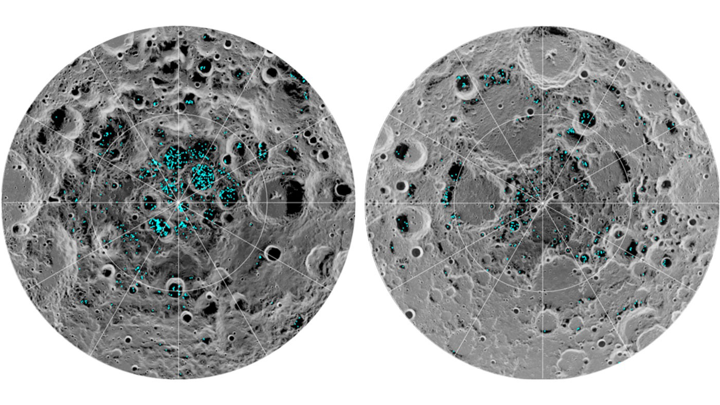
More answers began to arrive thanks to the Lunar Reconnaissance Orbiter (LRO). Launched in 2009, NASA’s sophisticated Moon mapper created detailed 3D and topographic maps of the lunar globe, charted minerals and volatiles (like water, methane, and carbon dioxide), documented radiation around the Moon, and searched for potential landing sites for crewed missions. The spacecraft skimmed over the Moon at a precarious altitude of just 30 miles (50 kilometers), circling from pole to pole. LRO’s neutron detector found hydrogen leaking from many crater floors and rims, and spotted bright regions within PSRs that scientists believed could be signs of water frost. LRO also took the Moon’s temperature, finding that some craters were chilled to –397 F (–203 C), proof that the areas had not seen sunlight for millions of years, as temperatures that low need a great deal of time to stabilize.
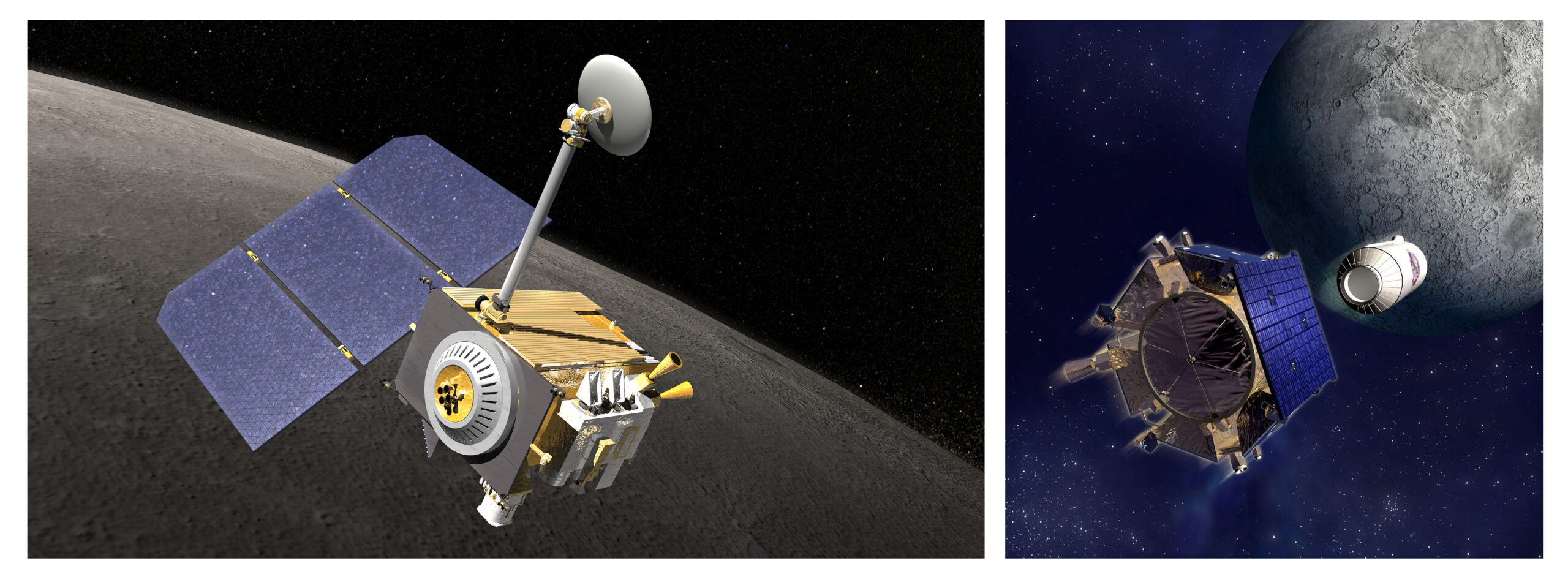
The search was aided by a probe that piggybacked along for the ride. The Lunar Crater Observation and Sensing Satellite (LCROSS) traveled aboard the Centaur upper stage that delivered LRO to lunar orbit. After deploying LRO in late 2009, the rocket followed a long, looping orbit back past Earth, returning to impact the Moon’s south pole. As the upper stage approached the Moon, LCROSS separated, firing small thrusters to delay its own impact. LCROSS first watched as the Centaur pulled ahead and flight engineers steered it into the floor of Cabeus Crater, where it blew some 350 metric tons of dust and rock into a great plume across the airless lunar sky. Four minutes later, after observing the impact, the little LCROSS followed, flying through the debris cloud. Its instruments sensed pure water-ice crystals in the impact spray just before LCROSS, too, crashed into the surface. Roughly 220 pounds (100 kilograms) of water vapor floated within the plume, which translates to 10 parts per million within the regolith. Cabeus is no snowfield, but enough water hides within its dust and rock to make it a useful target for future explorers, both robotic and human.
Researchers now estimate that some 20 percent of the near-surface material within some of the Moon’s permanently shadowed regions is water ice. Overall, lunar cold traps may cover some 15,400 square miles (40,000 square km), with about 60 percent of that in the southern polar provinces. Not all of these regions represent large water deposits. Micro-cold traps — tiny, protected regions in hollows, under rocks, and in shadowed depressions — could account for much of the lunar water supply, but can’t be verified from orbit. Surface missions are needed to identify and catalog them.
Beyond the water
Water is critical for sustained human presence on the Moon, but it is not the only target nestled just below the surface.
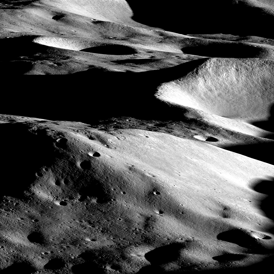
The South Pole-Aitken Basin and the environs near Shackleton Crater may well offer the greatest scientific return from any lunar missions to date. The Artemis Exploration Zone (AEZ) is the region within 6° latitude of the Moon’s south pole. The cratered terrain offers a geologically exciting target: Shackleton Crater spans 13 miles (21 km), diving to a depth of 2.5 miles (4 km). Its walls are steep, sometimes exceeding a slope of 35°. Temperatures never rise more than 180 F (100 C) above absolute zero. The interior offers many hazards to would-be explorers, with the deepest spot within its bowl sinking three times farther below the surrounding ground than the floor of the Grand Canyon does with its surroundings. The rims of other craters form towering summits that reach nearly 4 miles (6 km) above Moon’s average ground level.
Collecting samples that provide the ages of the South Pole-Aitken, Schrödinger, and Orientale basins are high scientific priorities. China’s Chang’e 6 mission brought back samples from the South Pole-Aitken Basin, the largest and most ancient impact basin on the Moon.
Noah Petro, project scientist for Artemis III, is confident that samples from Artemis will more clearly show us the Moon’s past. Models of the Moon’s formation have evolved over the past 60 years, he says. “Now we’re to the point of arguing about subtleties. What were the dynamics of the debris cloud? What were the sources of internal volatiles? How hot was it? Getting additional samples gives us that additional context we need.”
Geologist David Kring of the Universities Space Research Association agrees. All our current ideas about the Moon’s formation and history, “the lunar magma ocean hypothesis, the giant impact hypothesis, and so on — those ideas all came from the samples that astronauts brought back from the Moon,” he says. Artemis samples promise to reveal secrets related to other lunar mysteries, including the so-called lunar cataclysm that saw our satellite peppered with impacts, the origin of lunar volatiles, and details of the giant impact theory for the origin of the Earth-Moon system. There are “Moon stories” locked within the lunar samples, etched in stone.
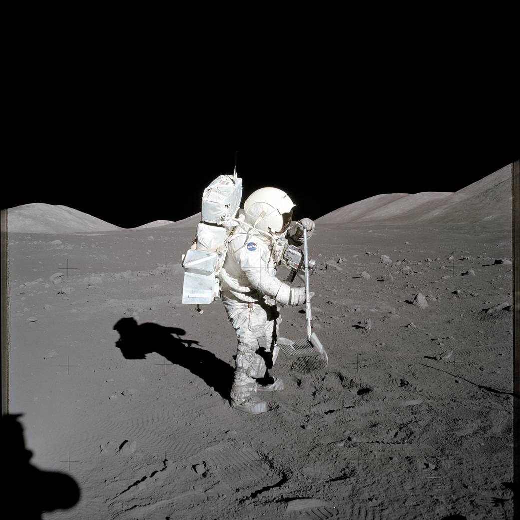
During Apollo, the scientific community learned that astronauts can be effective, skilled geologists. Artemis missions are tasked with returning at least 77 pounds (35 kg) of samples on each flight — far less than Apollo 17’s 243 pounds (110.5 kg). Based on lessons learned during Apollo, mission designers hope the Artemis crews will have an advantage in terms of efficiency and strategic sampling. But Artemis crews face a challenging task, according to the 2020 Artemis III Science Definition Team report: “[H]igh-priority investigations … require the collection of a diverse set of sample types, collected from geographically diverse locations broadly representative of the complex geology of the south polar region, and a total return sample mass from the Artemis III south polar site exceeding the average return mass for the Apollo missions.” If the performance of the Apollo astronauts was any indicator, Artemis crews will be up to the job.
Extravehicular activities in the AEZ will primarily collect samples tossed out by the impact that created Shackleton Crater roughly 3.6 billion years ago. These materials are particularly valuable for scientific inquiries, as they formed at the beginning of the period in which lunar volatiles began to condense. The crater wall of Shackleton crosscuts one of the ridges under consideration for landing. Where it cuts into the rise, layers of rock jut out. These layers likely contain precious material from the formation of the South Pole-Aitken Basin. As the oldest basin on the lunar surface, these samples will be an invaluable time capsule of the earliest days of the Moon. And boulders far larger than any visited by Apollo rest across the entire AEZ. These stony behemoths may contain samples of the lavas that shaped the crust of the infant Moon.
The combined samples returned by Artemis crews — including deep core samples — may well record 4 billion years of lunar history, shedding light on the ebb and flow of asteroid bombardment that visited the inner planets in their infancy.
Researchers can calibrate observations from orbiters using the composition and properties of sample material. Once scientists have the ground truth, remote sensing from above will be even more powerful. From a small number of landing sites, researchers can extrapolate to estimate regional or global abundances of volatiles, minerals, and more.
Some material, however, will prove more difficult to transfer. Preserving volatiles like carbon dioxide ice or water ice within lunar rocks would require refrigeration during the trip home, likely unavailable on early missions. Explorers will instead perhaps sample the Moon’s volatiles on site using portable equipment to reveal compounds in lunar material.
Peaks of Eternal Light
The southern lunar wilderness offers another advantage: extended periods of solar illumination for power. Because of the Moon’s subdued tilt, the Sun remains visible from elevated terrain at the poles almost year-round. Nineteenth-century astronomers Wilhelm Beer, Johann von Madler, and Camille Flammarion proposed that some of the Moon’s high ground constituted, as Flammarion called them, “Peaks of Eternal Light.”
Today, these peaks are more than mere curiosity — they could be sites where lunar inhabitants farm solar power to keep critical systems consistently running. Although spacecraft including the European Space Agency’s SMART-1, Japan’s SELENE, and NASA’s Clementine and LRO have searched for such peaks of eternal light, they have found none. But several spots come close. One location on the rim of Shackleton Crater is illuminated for more than 90 percent of the lunar day/night cycle. A second location on a ridge just 10 miles (15 km) away, called Malapert Massif, sees sunlight some 98 percent of the time, making it a good candidate for a solar farm. Malapert is a fairly flat-topped mountain — more like a “hump of eternal light” — rising 16,400 feet (5,000 meters) above its surroundings. In addition to its many hours of sunlight, its near-level ground should make for good landing sites.
More than geology
While at the lunar south pole, looking up is just as valuable as looking down.
Radio astronomy is muddied by the constant stream of radio and microwave transmissions from Earth. But the Moon’s mountains and crater rims can provide a shield from such interference. Lunar radio telescopes would have a completely radio-silent environment for studying the emissions of the Sun, other stars, the Milky Way, quasars, and much more. And the insulated environment is ideal for searching for faint signals that may reveal extraterrestrial intelligence. Solar wind studies will also benefit from a position on the Moon, whose lack of a global magnetic field will give scientists a clear view of the electrical fields and particles issuing from the Sun.
Additionally, astrophysicists plan to chart Earth’s transmissions from the lunar surface. Some terrestrial radio emissions are artificial, but our planet’s magnetic field has its own “broadcast,” which can be compared to faint emissions from exoplanets orbiting other stars, providing insights into the magnetic fields of these distant worlds — and perhaps even aiding our search for extraterrestrial life.
In all, the lunar south pole promises to return a wealth of science not achievable before. And with 55 nations working within the Artemis architecture (at the time of this writing), that scientific bonanza has already begun.