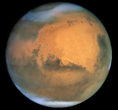
NASA and Google announced Monday the release of a new Mars mode in Google Earth that brings to everyone’s desktop a high-resolution, three-dimensional view of the Red Planet.
Besides providing a rich, immersive 3D view of Mars that will aid public understanding of Mars science, the new mode, Google Mars 3D, also gives researchers a platform for sharing data similar to what Google Earth provides for Earth scientists.
To view Google Earth’s Mars mode
-Install Google Earth 5.0
-After installation, open Google Earth 5.0
-Look for the ringed planet icon in the horizontal menu bar that runs across the top of the display window
-Click the ringed planet icon, and a dropdown menu appears: “Earth, Sky, Mars”
-Click “Mars”
-Enjoy!
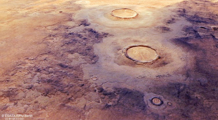
The mode enables users to fly virtually through enormous canyons and scale huge mountains on Mars that are much larger than any found on Earth. Users also can explore the Red Planet through the eyes of the Mars rovers and other Mars missions, providing a unique perspective of the entire planet.
Users can see some of the latest satellite imagery from NASA’s Mars Reconnaissance Orbiter and other probes orbiting the Red Planet. Viewers can learn about new discoveries and explore indexes of available Mars imagery. The new Mars mode also allows users to add their own 3D content to the Mars map to share with the world.
Monday’s announcement is the latest benefit from a Space Act Agreement NASA’s Ames Research Center in Moffett Field, California, signed with Google November 2006. Under its terms, NASA and Google agreed to collaborate to make NASA’s data sets available to the world.