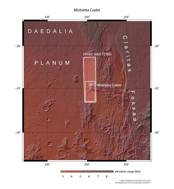
The European Space Agency’s Mars Express acquired the images November 28, 2013, toward the eastern boundary of the gigantic Tharsis Montes volcanic region where the largest volcanoes on Mars are found.
This volcanic region is thought to have been active until tens of millions of years ago, relatively recent on the planet’s geological timescale that spans 4.6 billion years.
The rough elevated terrain at the bottom of the main image is imprinted with three distinct but eroded impact craters, the largest of which is about 10 miles (16.5km) wide and named Mistretta. The ancient foundation it sits on once belonged to the vast southern highlands, but is now surrounded by a sea of lava, like many other isolated fragments that can be seen in the wider context image.
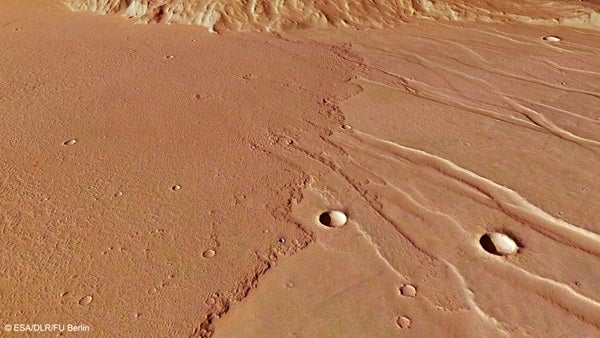
The first eruption produced the lava flow to the south of the island (to the left in the main image and to the right in the close-up perspective image). This flow subsequently experienced extensive faulting due to tectonic forces, resulting in the numerous trough systems.
The younger lava flow (right in the main image, left in the close-up image) must have taken place after the tectonic event that caused the faulting because it overlies both the older lava surface and the tectonic features. Indeed, at the front of the flow, several tongues of lava have flowed preferentially along the lower ground of the troughs.
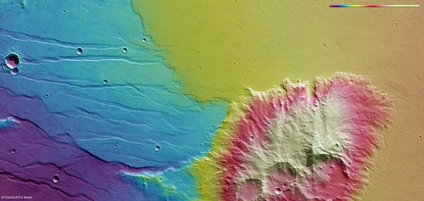
The younger lava flow also has a rough texture, with many small ridges on the surface. These features form as a result of speed gradients within the lava flow due to the difference in temperature between the hot faster-flowing interior lava and the cooler slower “roof” of the flow that is exposed to the atmosphere.
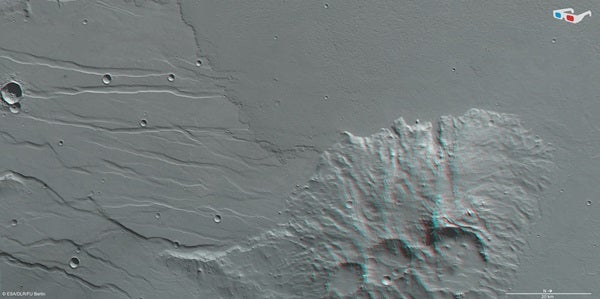
The wider Daedalia Planum region bears witness to numerous lava flows similar to these, each one overlaying the last. By carefully studying the boundaries between overlapping flows, planetary scientists can build up a picture of the eruption history of the Red Planet’s giant volcanoes.