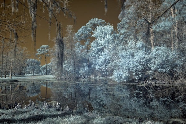
Agriculture places a heavy demand on declining water supplies. Yet each year, over-irrigation wastes huge amounts of water. Farmers in Bangladesh — like so many places around the world — face flood-and-drought cycles that make it challenging to manage water stress.
It turns out, there’s a satellite for that. NASA’s Landsat Program, which celebrates its 50th anniversary this month, beams back data that let observers track which fields have received too much water. Using the data, researchers at the University of Washington are developing a text-alert system to let farmers know when their fields are over-irrigated. More than 100,000 farmers across South Asia have signed onto the system, which farmers in Pakistan report saves them up to 40 percent in water consumption.
A long legacy
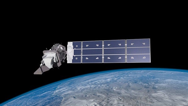
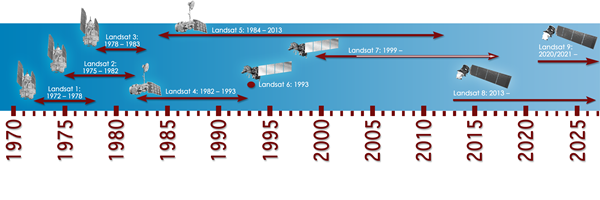
Landsat is the longest continuously running land-observing satellite program in the world. Originally called the Earth Resources Technology Satellite, the first Landsat satellite launched 50 years ago, on July 23, 1972. Since then, eight more satellites have continued its legacy without any gap in coverage — the new ones rotated into orbit as the old ones are decommissioned to safely burn up in Earth’s atmosphere. The most recent satellite, Landsat 9, launched just last year.
In fact, Landsat has become such a part of our world, as NASA imaging expert Joshua Stevens points out, that it even gets a cameo of sorts in the blockbuster film Kong: Skull Island. Not many actual satellites make it into Hollywood scripts.
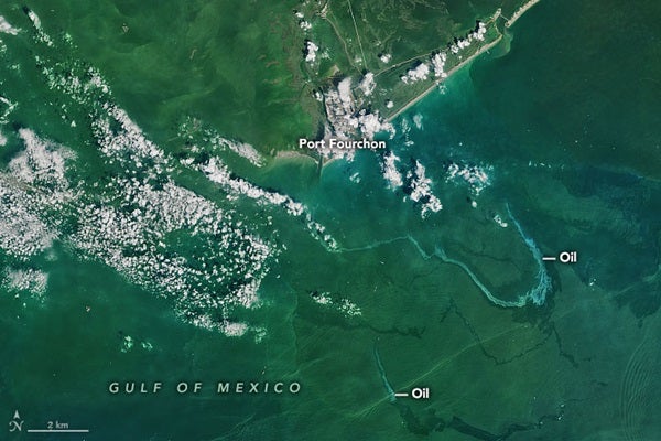
Landsat is an Earth resources monitoring satellite program designed to compile a complete picture of the globe every 16 days (or every 8 days when two satellites are active. To get such frequent coverage, its scanners only resolve areas down to about 100 feet (30 meters). That may not be fine enough to study, say, an individual tree, but you can still measure how much hotter a city gets than the forest around it — or even “see that your new garden is cooler than your driveway,” Stevens says. Every day, the data are used by thousands of people around the world for everything from anticipating wildfires to measuring oil spills to tracking receding glaciers. It is hard to imagine climate science without Landsat.
“It’s like a Swiss Army knife,” says NASA scientist Jeff Masek. And like most multitools, it’s useful in ways its earliest developers didn’t imagine.
The best part? NASA and the U.S. Geological Survey provide all the data for free.
The seed for Landsat’s technology dates back the 1910s. That’s when the first near-infrared landscape photographs were published. It turns out that healthy leaves have a special response to near-infrared radiation: They reflect most of it back. This makes them appear bright in infrared imagery. Dying or dead plants are far less reflective. By the 1930s, the U.S. Department of Agriculture was gathering infrared images by airplane to monitor crop health. During World War II, this same effect became useful for spotting planes, tanks, or other military equipment hidden under camouflage netting: Camouflage coloration might resemble vegetation to the human eye, but it couldn’t fool infrared film.
These two primary applications — agricultural monitoring and military intelligence — drove the early development of the technology that found a home aboard Landsat. As the Cold War took hold in the 1960s, the U.S. government funded a series of classified projects to enhance remote sensing in both areas. That research paved the way for a civilian instrument called a multispectral scanner. Previously, most remote sensing relied on aerial cameras capturing visual images (including infrared photos).
But Landsat’s multispectral scanner doesn’t take photographs. It gathers information. The sensors detect electromagnetic energy across a wide range of wavelengths, from short-wavelength visible light (what we see as deep blues and violets) down to longer-wavelength thermal infrared (a proxy for temperature). It then measures how much energy in each spectral band, or a specified portion of the electromagnetic spectrum, is emitted, absorbed, or bounced back by the target — hence multispectral.
A new view
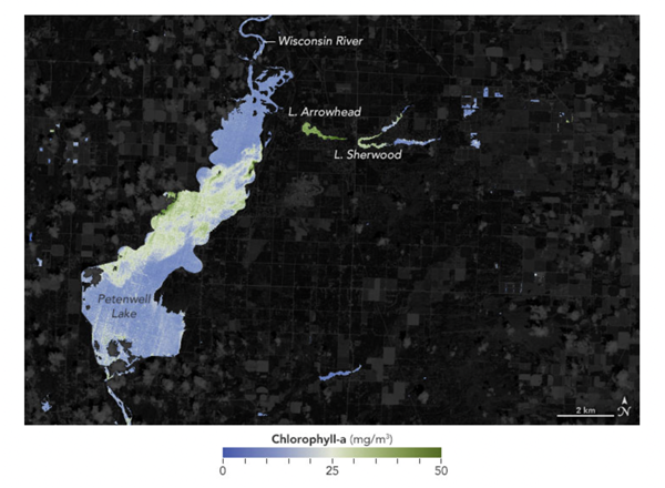
By gathering data across multiple wavelengths, the scanner returns information that can be used to envision phenomena on Earth: things like temperature, vegetation density, the level of photosynthetic activity (correlated to plant health), and even the amount of water a plant is transpiring through its leaves. This last measurement is what helps Bangladeshi farmers determine whether their crops are over-watered.
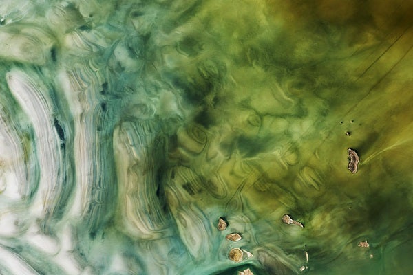
The data can then be turned into maps and images, offering a powerful tool for analysis and communication.
Samuel Goward, Professor Emeritus in the Department of Geographical Sciences at the University of Maryland, has been working with Landsat data since the program’s start in the 1970s. He points out just how revolutionary the shift from visual to computer-based data analysis was. “With the scanners you now have measurements of physical phenomena rather than a picture,” he says. “You can then convert each pixel into a biophysical measurement of what’s going on in that location.”
This was not simply a technological advance — it changed the way researchers thought about the planet. For Goward, Landsat meant “a new science of looking at planet Earth.”
Previously, in the laboratory, scientists tended to focus on discrete phenomena: individual cells, even particular molecules. With aerial photography, too, they could only identify what was or was not there — determining, say, that a tree once stood in the spot where a building now sits.
The digital sensors used by Landsat, though, make it possible to look at phenomena that are continuously variable over space and time, such as levels of photosynthesis. “I think learning that we could measure photosynthetic activity on the planet was as startling as anything to me,” Goward recalls. “It flipped the paradigm.”
Healthy plants with a high concentration of photosynthetic pigments bounce back high levels of near-infrared energy; as the plants sicken, their reflectivity decreases. Say you want to map how forests recover after wildfires or track the distribution of controlled burns across farmland. Landsat is the satellite for you.
“Being able to see in space and time and wavelength — all of those different phenomena — shows us the dimensions of the planet we live on,” Goward says. In fact, working with Landsat data has changed the way he views the world on a personal level. For example, he began to rethink what a ruler really is and how it works, he says. “A ruler is just a way to create discrete categories out of a continuous phenomenon called distance.”
Over the decades, Goward has shared this Landsat vision of the world with his students. To learn about remote sensing, he tells them, they first need to understand the electromagnetic spectrum. “And if you understand the electromagnetic spectrum, you understand not only the world we live in, but also the universe.”
But you can also understand things closer to home, too: how much water your crops need, whether a forest is thriving, or how floodwaters are moving through a region. Some people download Landsat data or use NASA’s Worldview maps to help them plan hunting or fishing trips, Stevens says. He himself sometimes looks at a special spot in Canada, where he used to go fishing with his grandfather. “Landsat is one of those lenses that can connect people to the things that they’re already familiar with,” he says. “And then you see change over time.”
Nothing is constant except change, so the saying goes — and if you look up into the night sky from anywhere on Earth, there’s a good chance Landsat is somewhere above you, recording those changes for all to see.