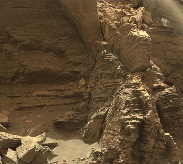
The images, which were taken by Curiosity’s Mastcam, show the beautiful formation in spectacular detail. Scientists say the formations were caused by sand dunes becoming buried, chemically changed, exhumed, and then eroded.
Curiosity was launched from Cape Canaveral Air Force Station in Florida in November 2011. It then landed on Mount Sharp in August of 2012 and reached the base of the mountain in 2014. The rover studies the climate and layout of Mars in preparation for future human exploration, and the information collected will serve as a foundation for the Mars 2020 rover.
Curiosity found evidence for ancient lakes, providing evidence that if Mars ever hosted life it would have been sustainable for microbes. It is also looking into how earlier habitable conditions transformed into Mars’ current dry, inhospitable state.
The images are helpful for scientists trying to gain a better understanding of how the visible landscape came to be the way we currently see it.
Curiosity has been driving in the Murray Buttes for over one month and is currently driving south up the base of the final butte on its last stop. On September 9, it started a drilling campaign and will continue higher up Mount Sharp once the campaign is completed.