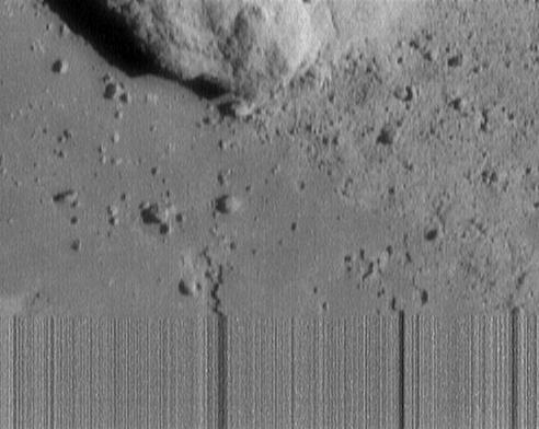
The view shows numerous secondary craters, formed by the re-impact of debris strewn from larger impact sites. Smaller surface details like this are becoming visible with increasing clarity as Dawn spirals lower in its campaign to map Ceres.
The region shown here is located between 13° and 51° north latitude and 182° and 228° east longitude. The image has been projected onto a globe of Ceres, which accounts for the small notch of black at upper right.
After transmitting the set of navigational images to Earth on May 23, Dawn resumed ion-thrusting toward its second mapping orbit. On June 3, Dawn will enter this orbit and spend the rest of the month observing Ceres from 2,700 miles (4,400km) above the surface. Each orbit during this time will be about three days, allowing the spacecraft to conduct an intensive study of Ceres.
Dawn is the first mission to visit a dwarf planet and the first to orbit two distinct solar system targets. It studied the protoplanet Vesta for 14 months in 2011 and 2012, and arrived at Ceres on March 6, 2015.