Scientists have devised a new way to study winds on Mars by examining sand dunes on the planet’s surface. The resulting wind map could help explain recent changes in the martian climate and provide vital information about devastating dust storms for future explorers.
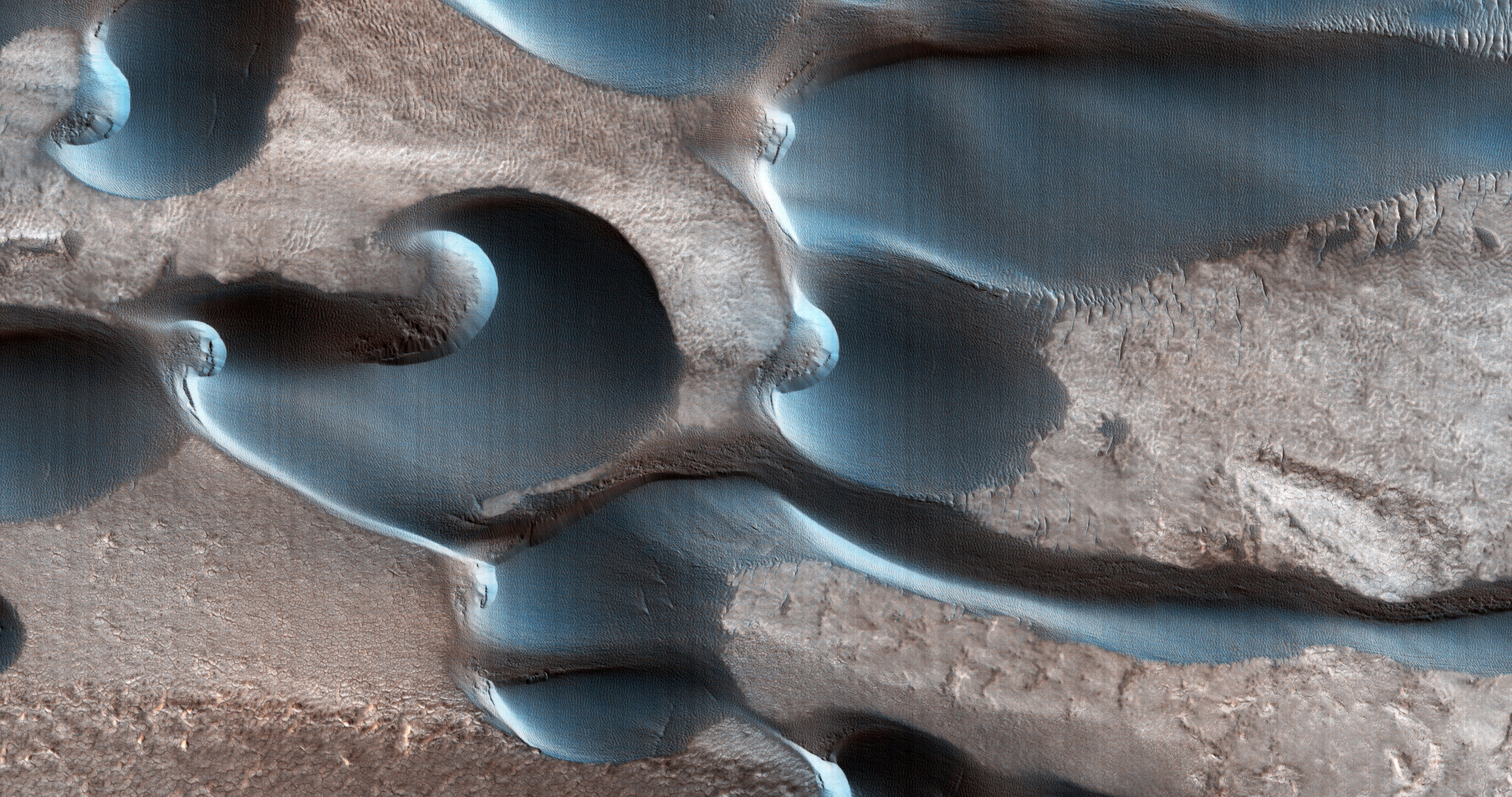
The researchers focused on martian barchans — distinctive crescent-shaped dunes that look a bit like the Starfleet insignia from Star Trek. (Barchans also form on Earth.) Their two “horns” point back to the prevailing wind and over time, these dunes slowly migrate in that direction.
“What’s wonderful about barchan dunes is that they are very indicative of the wind direction of the region,” planetary scientist Lior Rubanenko tells Astronomy. “They can tell us a lot about the main wind that is driving sand movement in the area we’re looking at.”
Making an ancient wind map
As on Earth, many types of dune form on Mars where sand and the wind interact. They include barchans; longitudinal dunes parallel to the wind; star dunes with arms radiating from a central peak; and transverse dunes, which form at right angles to the wind and are often found on beaches on Earth.
In fact, much of Mars’ landscape consists of vast fields of dunes. Mars doesn’t have any beaches: “It’s just a big desert,” Rubanenko says.
Scientists have studied martian barchans in the past, but they’ve only looked at small parts of the planet’s surface with high-resolution photographs. The photographs are often from the High-Resolution Imaging Science Experiment (HiRISE) on NASA’s Mars Reconnaissance Orbiter, which has circled the planet since 2006. HiRISE can resolve features just 10 inches (25 centimeters) across from orbit — about the size of a baseball, from an altitude of 186 miles (300 kilometers) above the martian surface.
The new study by Rubanenko and his colleagues, however, describes detecting barchans in lower-resolution photographs. Instead of HiRISE images, the new technique uses photographs from the orbiter’s Context Camera, or CTX, which produces images with a resolution of about 16 feet (5 meters) per pixel.
That’s enough to recognize the distinctive barchans, which can be more than 1,000 feet (305 m) across.
The researchers trained a machine-learning system to identify more than 700,000 barchans in CTX images of the entire martian surface, which have been compiled into a global mosaic. They then used the observations to create a global map that shows the directions of the planet’s prevailing winds.
Martian barchans migrate very slowly compared to barchans on Earth because the Red Planet’s atmosphere is thin and its winds are weak. As a result, barchans on Mars today were shaped by the winds of the past: “We’re essentially looking at a snapshot of the average winds on Mars as they’ve been in the last thousands of years,” Rubanenko says.
The researchers found the martian winds are dominated by patterns that prevail during the southern summer, with mostly northerly winds around the equator and a cyclonic rotation around the martian North Pole. They also found their wind map agrees well with direct observations, which can be gleaned from the reports of robotic Mars rovers.
So far, the technique isn’t sensitive enough to detect seasonal changes. But Rubanenko hopes it can be refined by measuring the limbs of asymmetric barchans — where one horn is longer than the other — to reveal seasonal wind patterns.

Dust storm coming
It also might be possible to use the wind map to predict some of the Red Planet’s dust storms.
Rubanenko points to the giant 2018 dust storm on Mars that blanketed NASA’s Opportunity rover and ultimately led to the end of its mission, and warns that similar storms occur every few years. “When the first humans arrive on Mars, a global dust storm could completely wreck the mission,” he says. “So we want to understand if we can predict those storms.”
Planetary geologist Matt Chojnacki is one of the scientific leads for the HiRISE camera. He wasn’t directly involved in the latest study, but reviewed it for inclusion in the journal Geophysical Research Letters.
“It’s an excellent application of machine- learning,” Chojnacki tells Astronomy. “Many of us have done this manually for years, focusing only on one region of Mars, and it’s tiring work,” he says. “And now Lior Rubanenko comes up with a global map of more than 700,000 barchans — it’s like were being run out of business.”
Planetary scientist Susan Conway, an expert on the martian surface who also wasn’t involved in the study, adds that understanding the winds on Mars is vital to science there. “Wind causes dust storms, and when a global dust storm occurs it has effects on both landed missions and those in orbit,” she says. “This study could be a step towards better understanding why dust storms sometimes, but not always, develop into global events.”