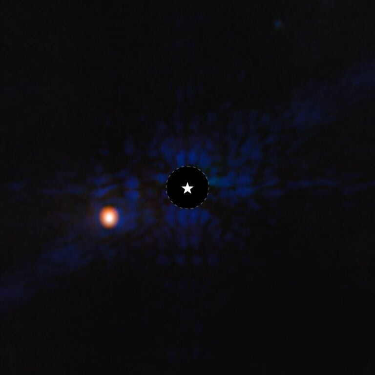
When Mars Express set sail for the crater named after Portuguese navigator Ferdinand Magellan, it found a windblown plateau and mysterious rocky mounds nearby.
Stretching across 120 by 70 miles (190 by 112 kilometers), this region of Mars covers an area of about 8,216 square miles (21,280 square km), which is roughly the size of Slovenia. It is located to the southwest of the volcanic region Tharsis on the southern highlands of Mars, near the crater Magellan. The impact crater is about 62 miles (100 km) across.
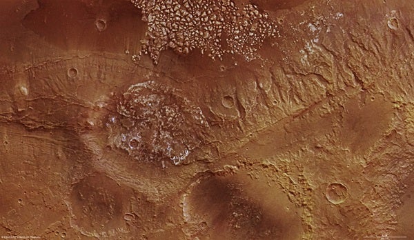
In the upper edge of the image, there are light-colored, irregular protrusions. These features are up to 1.2 miles (2 km) tall and are probably large rock fragments or mounds of rock. However, their formation is still debated.
One possibility is that the top layer of rock was shattered by the shockwaves from an impact; another possible explanation would be from a process called subrosion. On Mars, subrosion is widely observed when rising magma heats frozen ground water, which melts and removes subsurface material as it flows away. This leads to a honeycomb of cavities that eventually collapses due to the weight of the overlying rock layers, leaving the irregular mounds standing.
The northern part of the region displays linear features with a preferential northwest-southeast orientation. These eventually lead to deep, well-defined valleys and are likely to be faults formed during either an impact event or the upsurge of the Tharsis region that created enormous stresses in the planet’s crust. Examining the geometry of fault zones offers clues to the level and the direction of the stress exerted on the rock.
A rather smooth, barely fractured plateau is made up of the same material as the highly fractured mounds in the west. Fine trails run from southwest to northeast across here. These could be an indication of erosion by fine dust particles carried on the wind, sandblasting the plateau smooth.
With a ground resolution of about 82 feet (25 meters) per pixel, the data was acquired for the region of the Magellan Crater at about 34° south, 185° east during Mars Express’ orbit February 6, 2009.