Hellas Basin sits in the southern highlands of Mars and is one of the solar system’s largest impact basins, with a diameter of 1,400 miles (2,300km). It is thought to have formed some 3.8–4.1 billion years ago during the heavy bombardment that subjected all the inner solar system planets to a heavy rain of asteroids and comets.
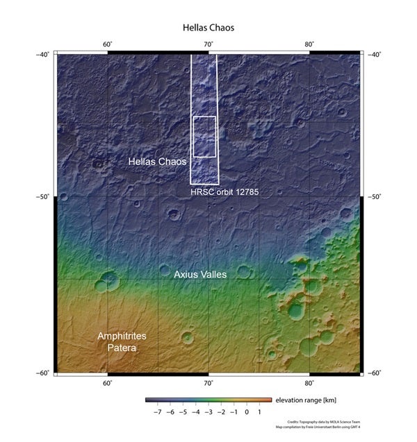
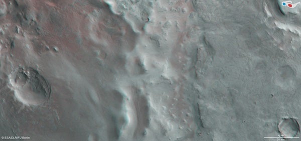
The region presented here, known as Hellas Chaos, lies in the southern central part of the basin. The high-resolution stereo camera on Mars Express captured it January 23.
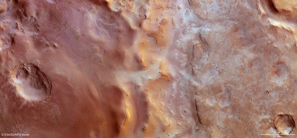
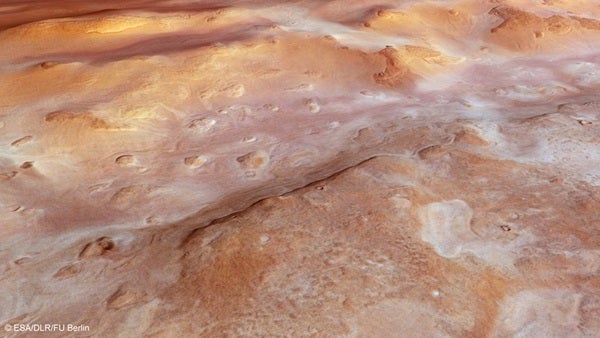
Much of the scene is dusted with carbon dioxide frost, although in places the underlying surface is exposed. In contrast to the frosty terrain, the ridges running through the center of the image appear golden, probably from the low Sun angle of around 25°. Flows of sediments are also visible on some portions of their flanks.
To the right again, the curved outline of large sublimation pits can be seen, interspersed with polygonal-patterned terrain. These features develop as a result of the contraction and relaxation during freeze-thaw cycles as the seasons change.
In the top-right corner, a large flat-topped “mesa” rises from the surface. The flanks of the mesa are covered with dust that seems to flow down into the surrounding depression. Here, the material is pushed together, presumably from successive flows producing parallel ridges of piled sediment layers.
Smaller craters also can be seen in the right-hand part of the image, some with debris blankets that appear fluidized, indicating the presence of subsurface ice that melted during the impacts that created the craters.
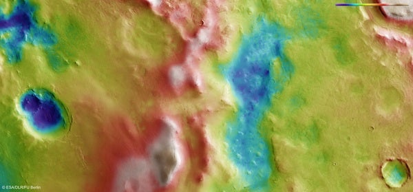
Meanwhile, in the top-left corner of the image, a region of lower elevation is littered by curious ridges and blocks of material that exhibit the same rough textures as the knobs in the central part of the image.
The origin of the Hellas Chaos region in general is widely debated. One idea is that large amounts of sediments were deposited inside the Hellas Basin and later eroded by wind and water.
Another idea suggests that volcanic activity might be the cause. The context map shows extensive lava flows around the “chaos,” perhaps related to the nearby volcano Amphitrites Patera.
Alternatively, floods of lava inside the Hellas Basin, following the formation of the basin itself, could have given rise to the structures seen in this region today.

