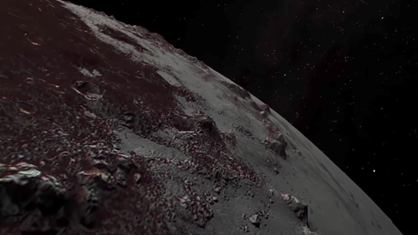
In honor of the two-year anniversary of NASA’s New Horizons Pluto flyby on July 14, 2015, the New Horizons team released two flyover videos and detailed maps of Pluto and its Moon, Charon.
The maps are made from several images taken by the spacecraft’s Long-Range Reconnaissance Imager (LORRI) and the Multispectral Visible Imaging Camera (MVIC) stitched together. The videos have been enhanced to bring out the colors and topographic details of Pluto and Charon.
The video of the Pluto flyover starts in Sputnik Planitia, the nitrogen ice plain on the dwarf planet, before passing over the Cthulhu Macula crater, then flying over the highlands of Voyager Terra and heading towards Pioneer Terra. It ends with the spacecraft passing over the Tartarus Dorsa terrain.
The Charon video begins in the moon’s northern hemisphere before passing over the Serenity Chasma canyon, moving on to the Dorothy Gale crater, the Mordor Macula polar hood of the Moon, and the Oz Terra terrain, before ending in the plains of Vulcan Planum and Clarke Montes mountains.
You can check out the videos to see for yourself what New Horizons saw and find the maps the team produced here.