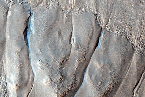
Gullied crater wall on Mars.
NASA/JPL/University of Arizona
September 8, 2009
Thousands of newly released images from more than 1,500 telescopic observations by NASA’s Mars Reconnaissance Orbiter show a wide range of gullies, dunes, craters, geological layering, and other features on the Red Planet.
Thousands of newly released images from more than 1,500 telescopic observations by NASA’s Mars Reconnaissance Orbiter show a wide range of gullies, dunes, craters, geological layering, and other features on the Red Planet.
The High Resolution Imaging Science Experiment (HiRISE) camera on the orbiter recorded these images from April through early August of this year. The camera team at the University of Arizona, Tucson, releases several featured images each week and periodically releases much larger sets of new images, such as the batch posted September 2.
The new images are available at http://hirise.lpl.arizona.edu/releases/sept_o9.php.
Each full image from HiRISE covers a strip of martian ground 3.7 miles (6 kilometers) wide, about two to four times that long, showing details as small as 1 yard (1 meter) across.